Please sign in as a member or guest below to access it.
Please sign in as a member or guest below to access it.
Each has its own character and may change dramatically as it winds its way through the state.
Texas
rivers are fickle creatures. In spring, they can swell and overflow their
banks, flooding cities and destroying homes. In summer, revelers float on tubes
beneath towering pecan trees or perch on banks with rods in hand. After the
scorching summer months bake into fall, they can run to a trickle or dry out
altogether. Come winter, up in the Panhandle, rivers can freeze, while along
the border, adventurers can explore the massive canyons cut by the Rio Grande
or search for migrating birds along its banks in the valley all year.
Each
Texas river has its own character and may change dramatically as it winds its way
through the state. Follow this guide to the longest and most glorious waterways
in Texas.
The
1,360-mile river runs from the Panhandle along the Oklahoma border until
draining into the second-largest river basin in the southern Great Plains. Its
name comes from the silt of red-hued sedimentary rocks that color its waters.
In the early 19th century, the Red River marked the southern border between the
United States and New Spain, and it remained so until the Texas Revolution.
Today, reservoirs along its course are popular destinations for anglers and
boaters.
A
tributary of the Arkansas River, the Canadian crosses Texas between New Mexico
and Oklahoma through the northern fridge of the Panhandle. The Canadian’s
riverbed is shallow and sandy, cutting a narrow trench through the wide-open Plains
landscape. Northeast of Amarillo, a dam creates Lake Meredith, a Plains oasis
that provides water for a number of Panhandle towns and cities.

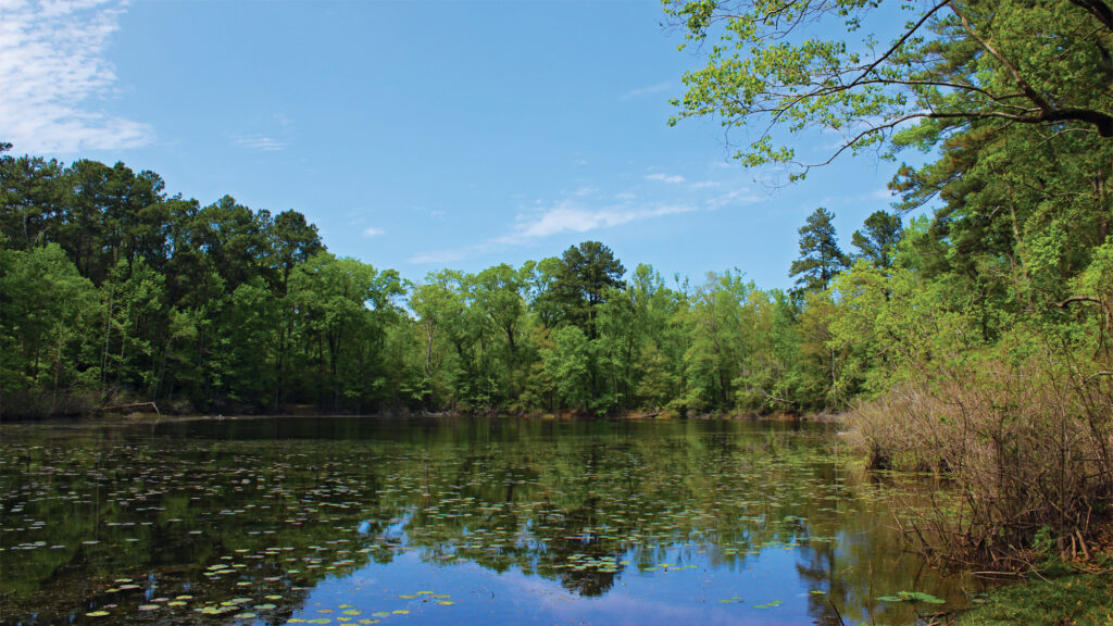
Seeping out of the thick woodlands of East Texas, the Sabine River forms the Texas-Louisiana border as it runs its course southward toward the Gulf of Mexico. It eventually spills into Sabine Lake, whose fresh waters help fuel one of the state’s most fecund wildlife estuaries.
The
Neches River sits at the convergence of several diverse ecological habitats. The
U.S. Fish and Wildlife Service thwarted efforts to dam the river by establishing
the Neches River National Wildlife Refuge, helping to ensure that much of the
river’s course remains in its natural state.
The Trinity River is formed by the flow of the massive North Texas watershed southward toward the Gulf of Mexico. Branches of the river run through Fort Worth and Dallas, which has long dreamed of utilizing the river either as a shipping canal or as a grand urban park. Farther south, the Trinity’s regular flooding feeds farmland in the central part of the state.
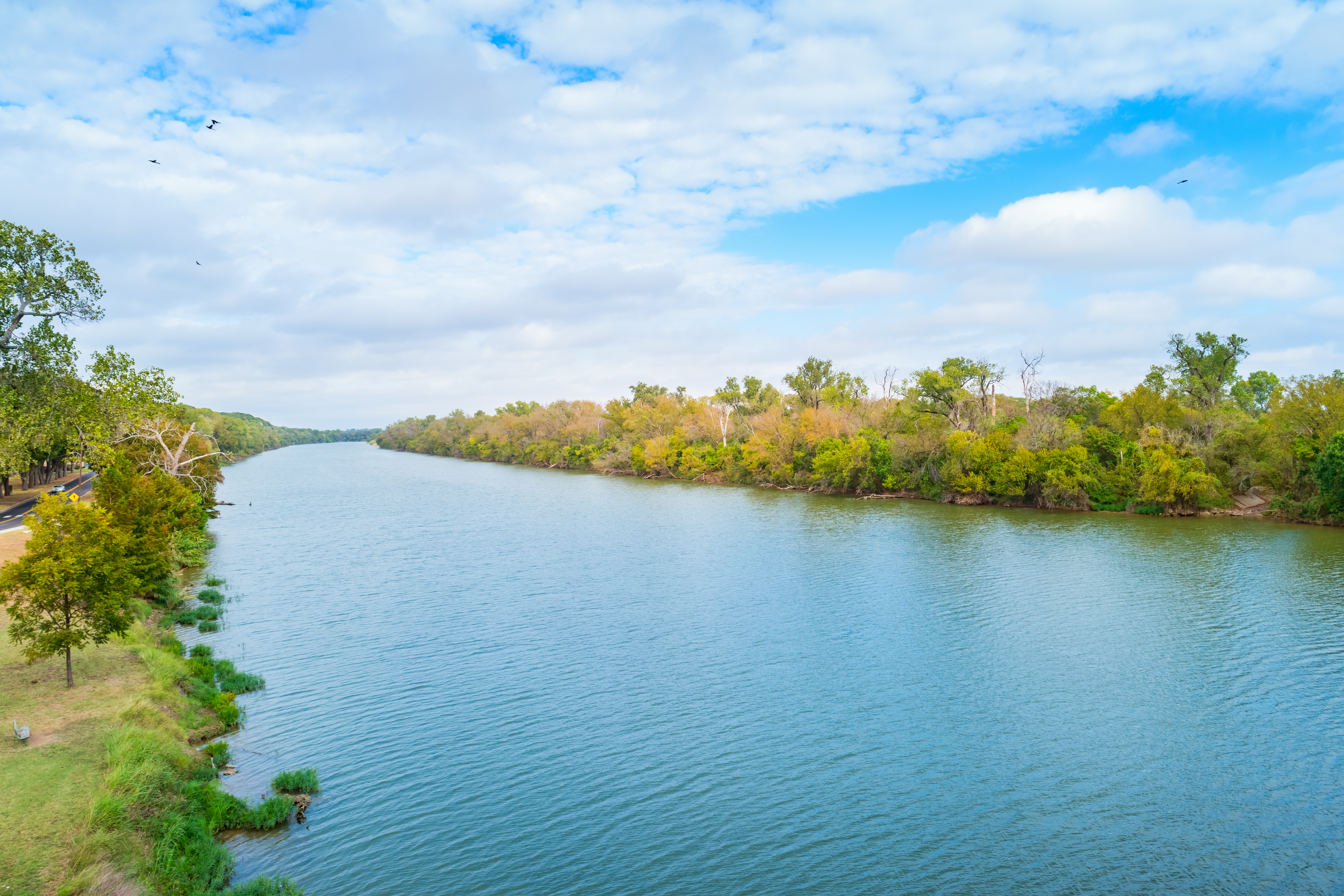
The Brazos River runs off the Llano Estacado diagonally through the state before draining into marshes near Freeport. The lower Brazos river valley was a major early settlement site; Texas Independence was declared near its banks. The river also inspired one of the best books ever written about Texas, John Graves’ Goodbye to a River, which recounts the author’s canoe trip down the Brazos in the days before it was dammed. The Brazos remains popular for canoeing, swimming, camping, and fishing.
Before European settlers arrived in Texas, Karankawa and Akokisa tribes lived in and around the two forks of the San Jacinto, the river best-known as the site of a critical battle of the Texas Revolution. Today it sits at the center of a major hub of the petroleum industry.
Like
the Brazos, the Colorado begins in the Llano Estacado and winds through the
Hill Country before emptying into the Gulf of Mexico; during early exploration,
the Colorado and the Brazos were often mistaken for each other. Today, the
Colorado runs through Austin, where it has been dammed to create Lady Bird
Lake.
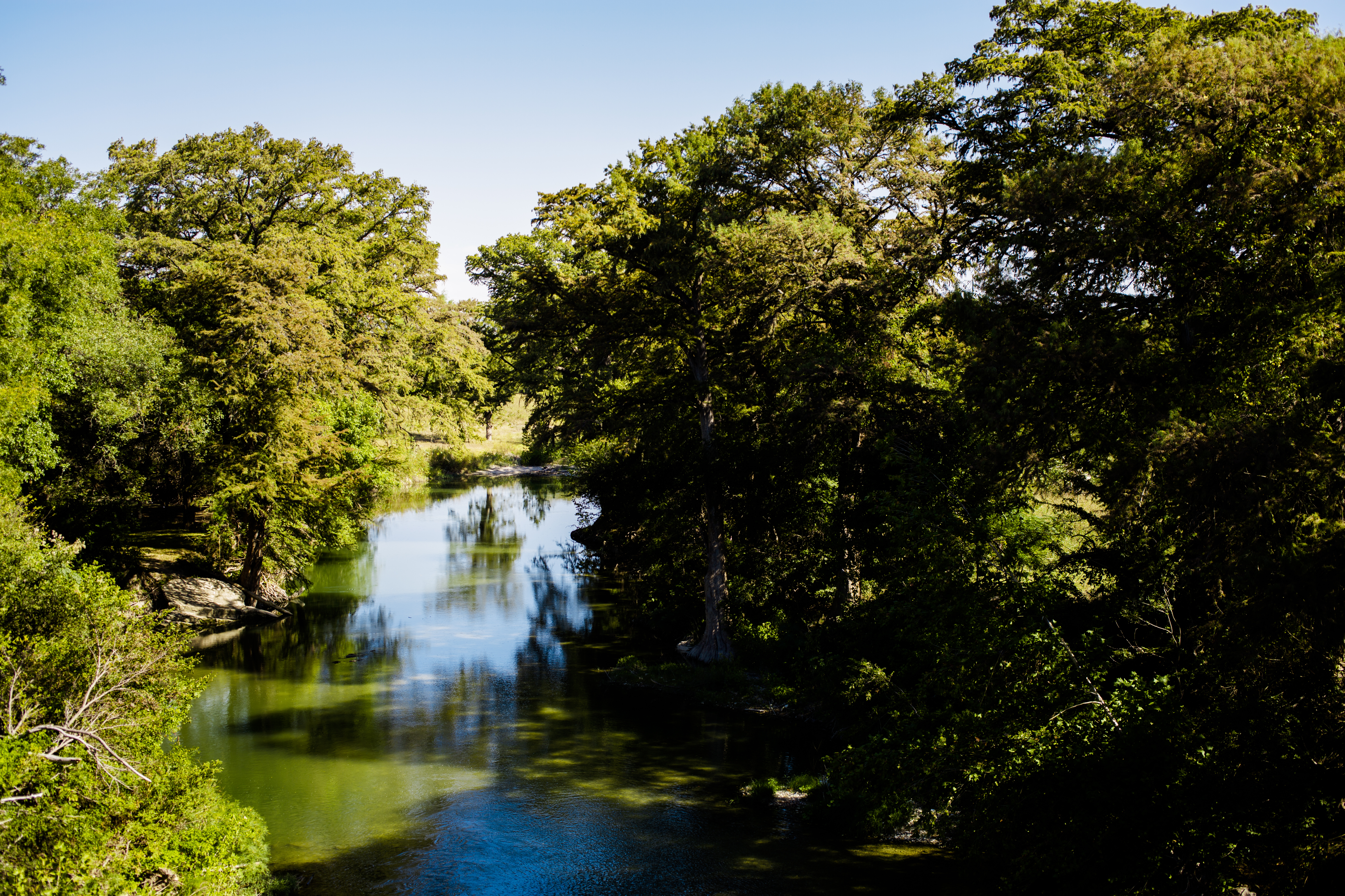
Cutting
through some of the most stunning landscapes of the Hill Country, the river was
an important water route for Native American tribes, Spanish explorers, and
early German settlers. Today, it is one of the most popular Texas rivers for
rafting, canoeing, fishing, and tubing.
Although
it’s one of Texas’ more diminutive rivers, the San Antonio played an outsized
role in the state’s history. Originating in a series of springs, it flows
southward before joining the Guadalupe River near the Gulf of Mexico. It’s best-known
as the centerpiece of the popular San Antonio River Walk.
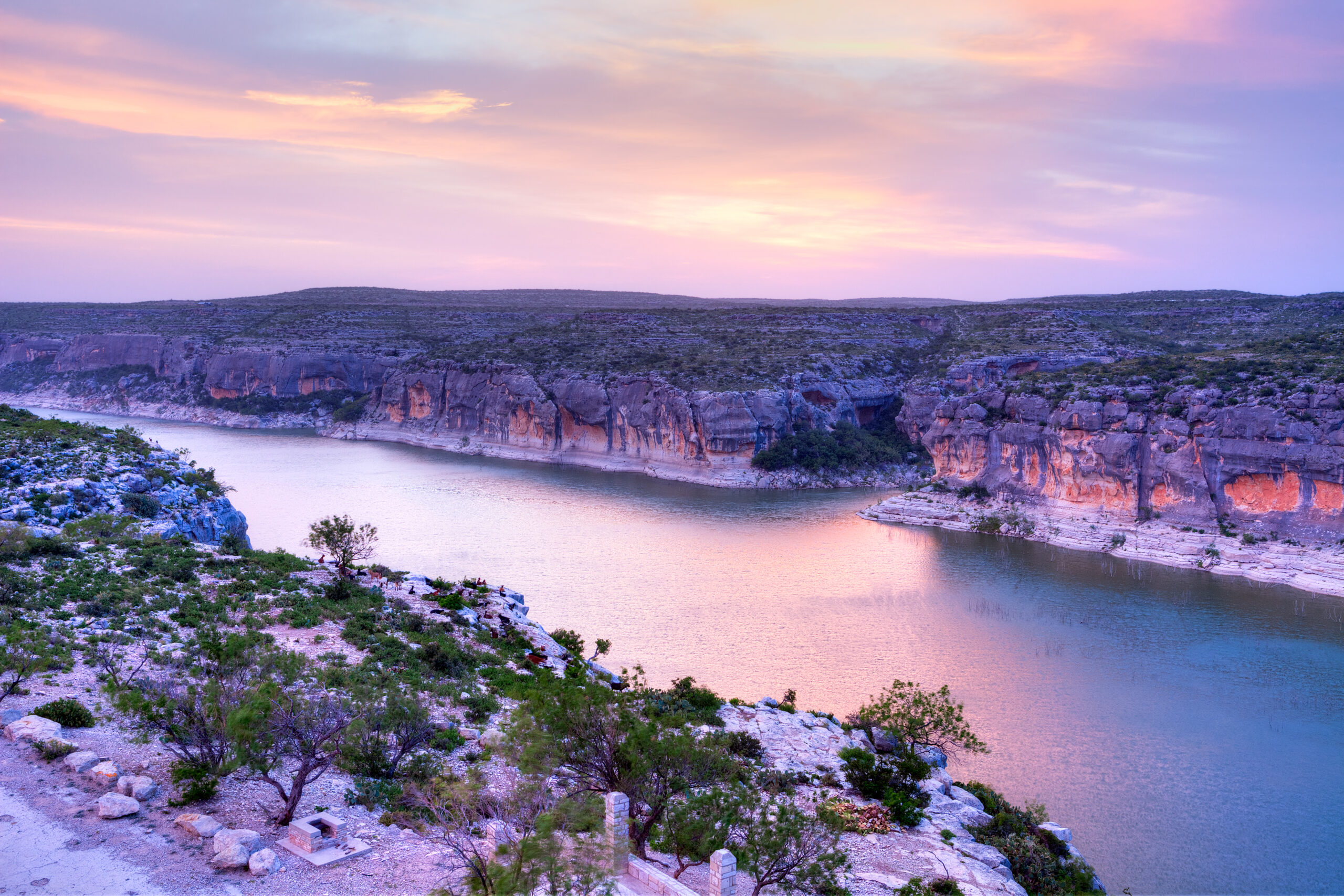
Once considered the starting point of the Wild West, the Pecos cuts a winding course through some of the most arid parts of Texas and, as a result, has attracted life for millennia. Visitors can look for ancient rock art along its shores or simply enjoy the stunning beauty of the long canyons the river carves into the desert as it makes its way to the Rio Grande.
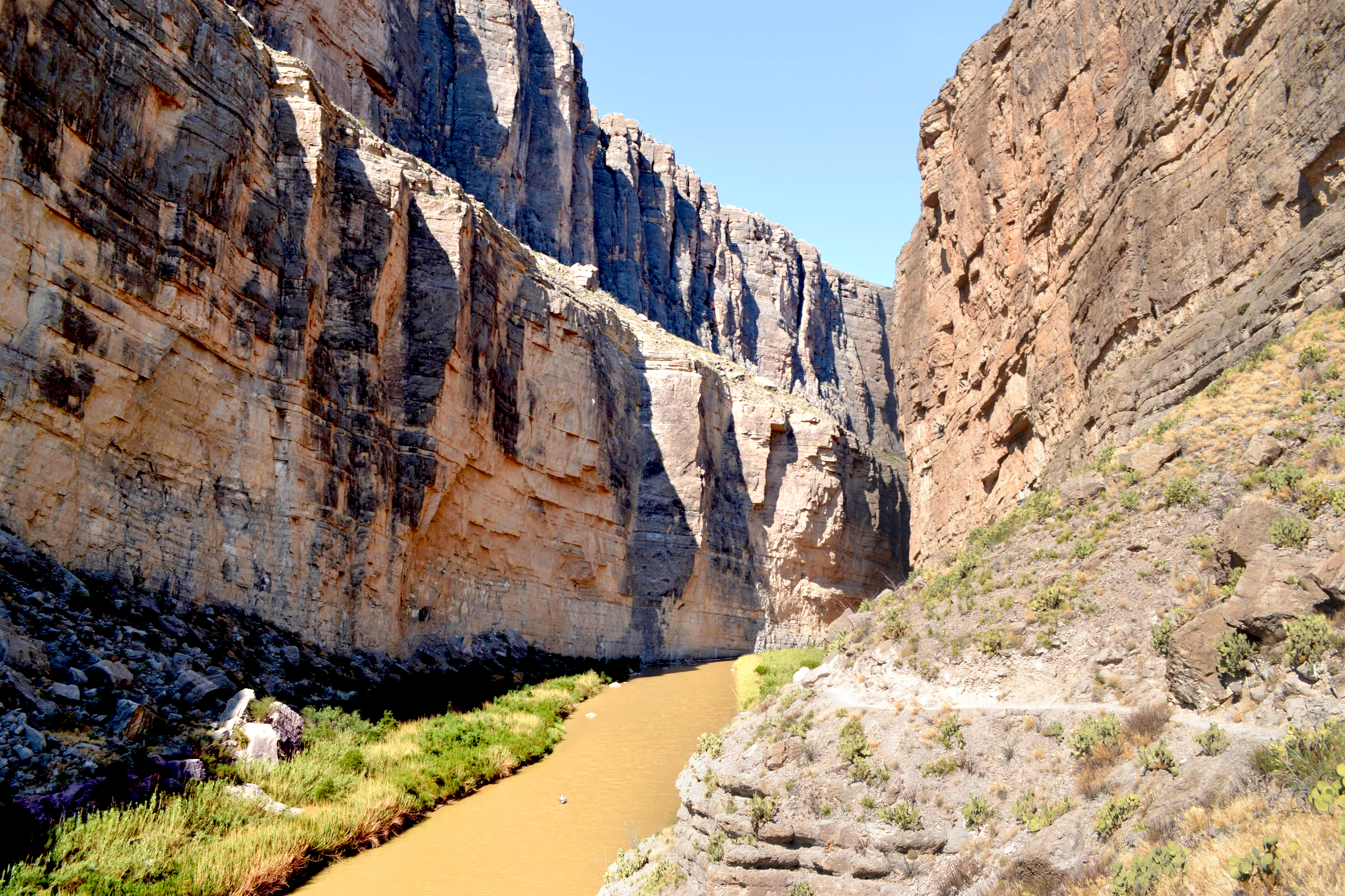
From the spectacular canyons of Big Bend to the marshy lowlands of the valley, the Rio Grande is the longest river in Texas. Its course gives the state its iconic shape as it forms the southern border of the U.S. The Rio Grande also sustains some of the most diverse and vibrant ecological regions in Texas. It’s an unparalleled spot for canoeing, fishing, camping, and hiking. Look for birds along its banks.
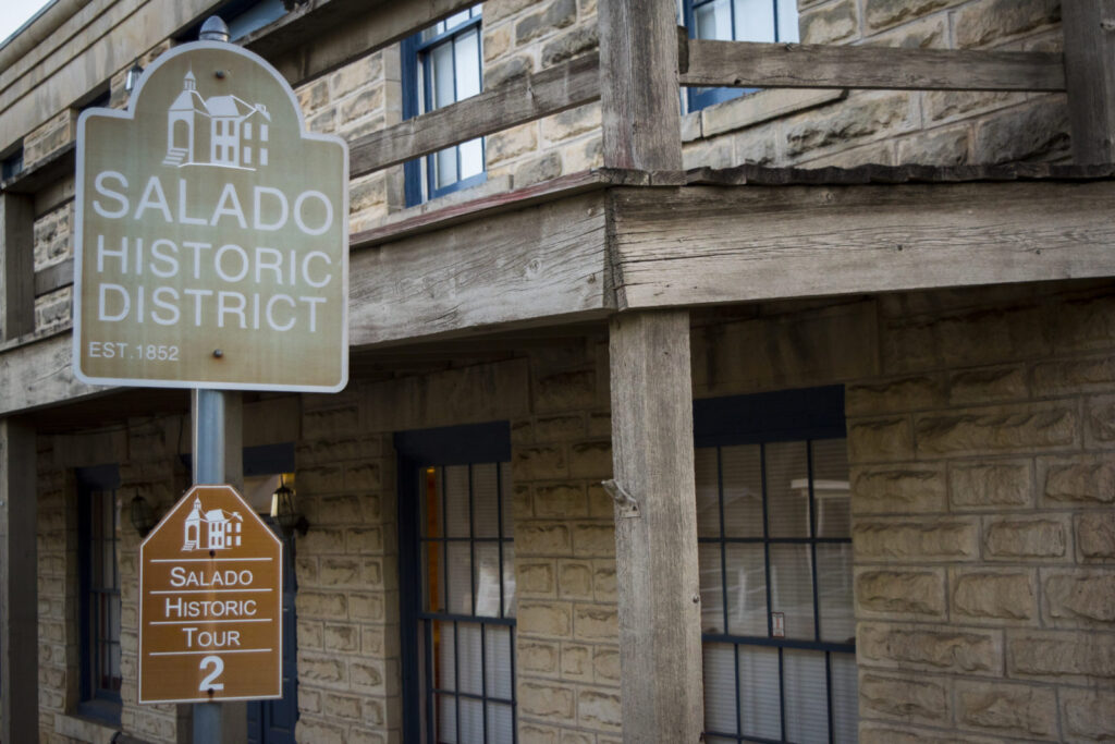
A number of Salado’s older Victorian homes have transformed into bed-and-breakfasts. Maybe that’s why so many people say “I do” there.
Texas Travel Guide: South Texas City Spotlights
The ultimate roundup of towns in South Texas.
A breath of fresh air with a view.
Start by floating down the Guadalupe River, end by two-stepping at Anhalt Hall.

The 10 Best Pizzerias in Texas
No matter how you slice it, these are the best pizza joints in Texas.
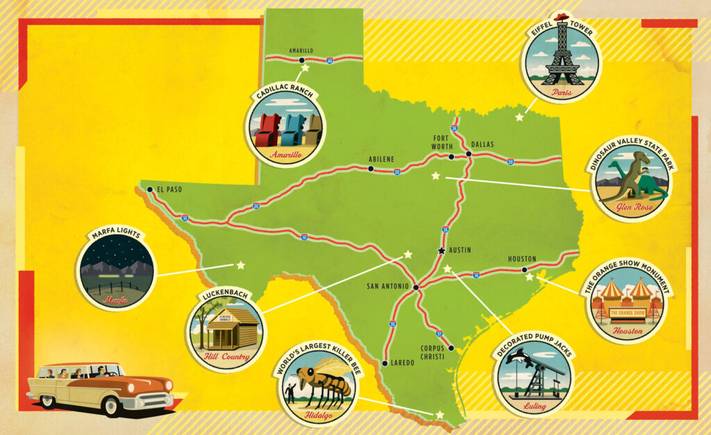
Looking for adventure? Our list of must-see attractions and bonus foodie's guide guarantee the ultimate Texas road trip.