Please sign in as a member or guest below to access it.
Please sign in as a member or guest below to access it.
The names of Texas’ rivers are etched into the history of the American West.
The names of Texas’ rivers are etched into the history of the American West: the Red, Brazos, Blanco, Colorado, Canadian, Guadalupe, Llano, Devils, Pecos, Rio Grande.
Before European settlers came to Texas, these rivers served as important travel routes. Settlers built their new forts and towns near the rivers that provided water, transit, and, sometimes, protection. The most successful of these towns grew into the state’s great cities.
But Texas’ rivers are also fickle and temperamental creatures. Just as they helped boost commerce and growth, they also wreaked havoc and destruction through unexpected and devastating flooding.
The story of Texas cities is often a story of their relationship to the rivers. Successive generations have struggled to control, tame, utilize, and beautify their urban rivers. Today, in four of Texas’ biggest cities, these rivers are the crown jewels.
Native American Crossroads
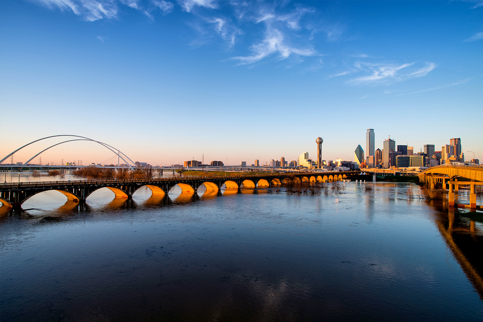
It’s often said that Dallas is a city with no reason to exist. But the spot along the Trinity River was an important crossroads of Native American paths, and founder John Neely Bryan took advantage of those connections.
Trading Post
Bryan founded a trading post there, and soon, a bridge crossing was constructed, setting the stage for Dallas-Fort Worth’s emergence as a commercial boomtown and continental crossroads — and the fledgling city’s century-long struggle to tame the Trinity began.
Dreams of a Park
Early dreams of transforming the river into a shipping canal stretching all the way to the Gulf of Mexico were eventually shelved. In recent years, Dallas has come together around a vision for a grand park along the banks of the straightened, levee-confined floodway near downtown. But the Trinity River Project, which includes a 2016 design by acclaimed landscape architect Michael Van Valkenburgh for a reconstructed riverine landscape in between the levees, is still a work in progress.
Urban Forest
Today, you can enjoy biking on paths in the floodway, exploring the nation’s largest urban hardwood forest, searching for the many species of birds that traverse the Trinity, and marveling at the gleaming white suspension bridges designed by acclaimed architect Santiago Calatrava.
Wetland Preserves
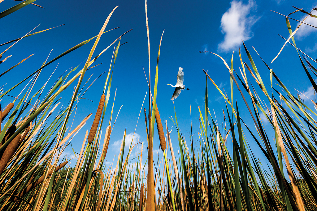
The highlight is the Ronald Kirk Pedestrian Bridge, an early-20th-century concrete viaduct that’s been closed to traffic and transformed into a park hovering above the floodplain. In the early morning, you can spy ibis, egrets, and heron feeding in the wetlands that have been constructed just north of the bridge.
Fort Worth’s Pavilion
As Dallas has struggled to realize its Trinity Park dreams, Fort Worth has taken advantage of its access to a gentler branch of the Trinity to transform the former stock cattle water hole into a park with a music pavilion that’s popular for summertime concerts.
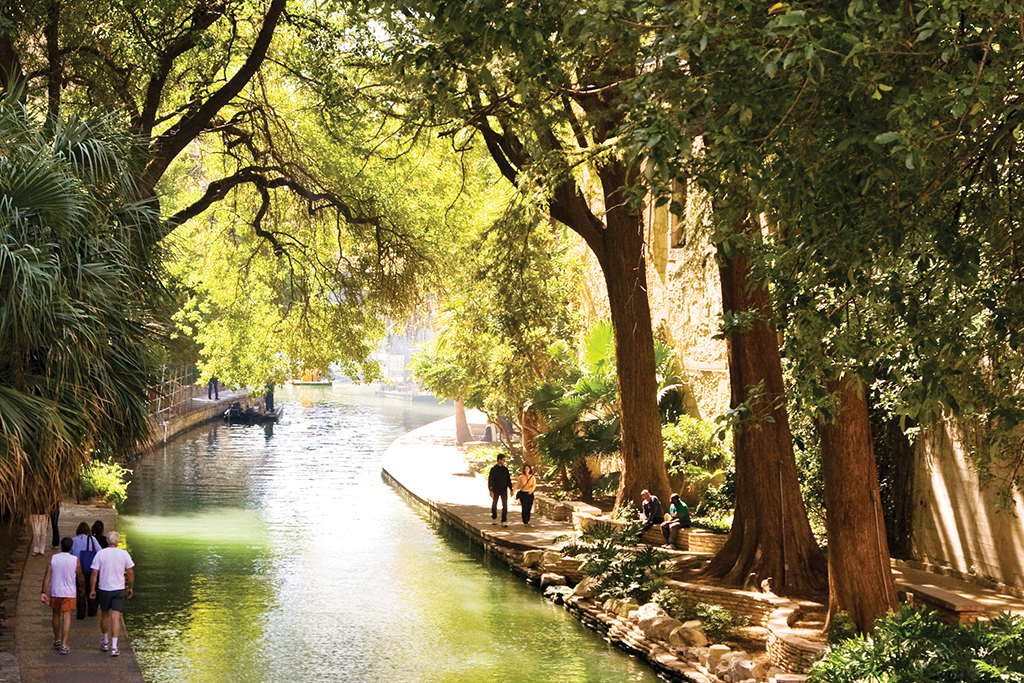
Spanish Missions
In his earliest writings about Texas, the Spanish explorer Álvar Núñez Cabeza de Vaca identified the San Antonio River in 1535 as a site ripe for potential settlement. By 1691, the Spanish had named the river after Saint Anthony of Padua and established five missions along its banks.
Revolutionary Waters
The river saw multiple battles during the Texas Revolution, including the famous Battle of the Alamo and the Goliad massacre. After the revolution, the San Antonio River played an important role in San Antonio’s emergence as one of Texas’ great cities.
The First River Walk
Today, most people encounter the river along the wildly popular San Antonio River Walk. The idea came after a disastrous 1921 flood, which ravaged San Antonio and killed around 50 people. Plans to implement flood control included the construction of a bypass channel that would allow for gentler flow of the San Antonio river through the city, transforming its banks into parks, pedestrian walkways, and plazas for restaurants. The first restaurant opened in 1946, and over the decades, the promenade has been improved and extended, inspiring similar urban river walks in cities across the country.
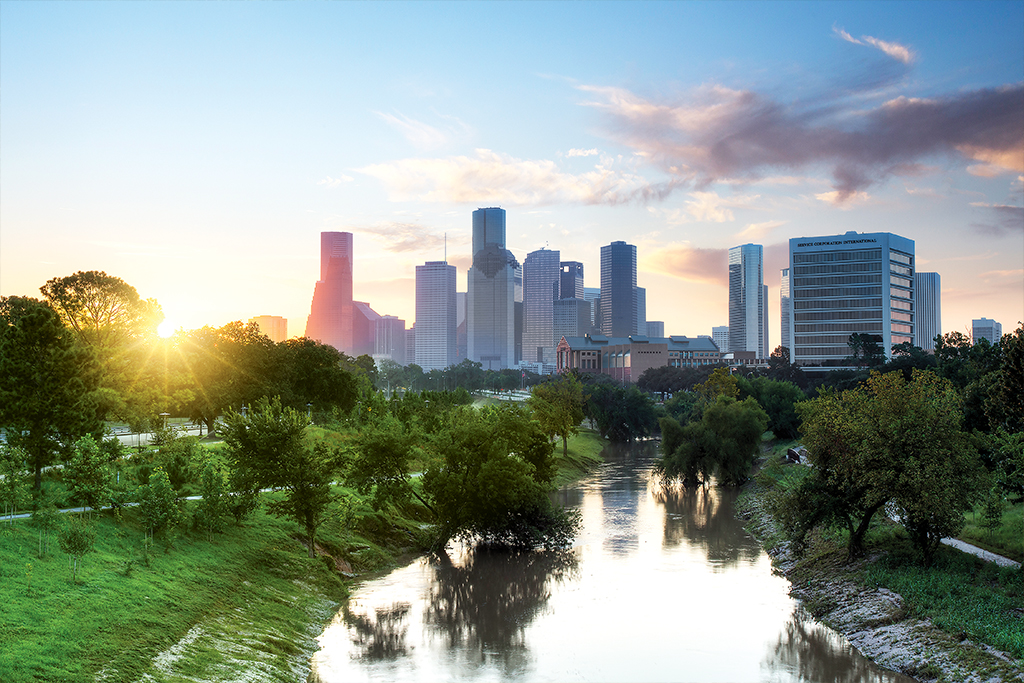
Inland Haven
Houston’s intrepid founders located their future city’s spot along a slow-moving river that drains into the Gulf of Mexico. Houston boomed after hurricanes ravaged nearby Galveston, prompting business to move to safer inland pastures. But the bayou has caused its own problems over the years, flooding the low-lying city on numerous occasions after heavy rains.
Bayou Cleanup
Beginning in the 1960s, Houstonians began to see their river as a precious natural asset. The establishment of the Bayou Preservation Association led to the creation of several parks along its banks. It also prompted efforts to clean up the bayou’s waters.
Rehabilitation
The crowning effort of this initiative came together in the early 2000s, when a new Buffalo Bayou Partnership planned a billion-dollar rehabilitation of the river, restoring habitats, adding hike-and-bike trails, opening canoeing and kayaking facilities, and turning Buffalo Bayou into a cultural, recreational, and ecological destination.
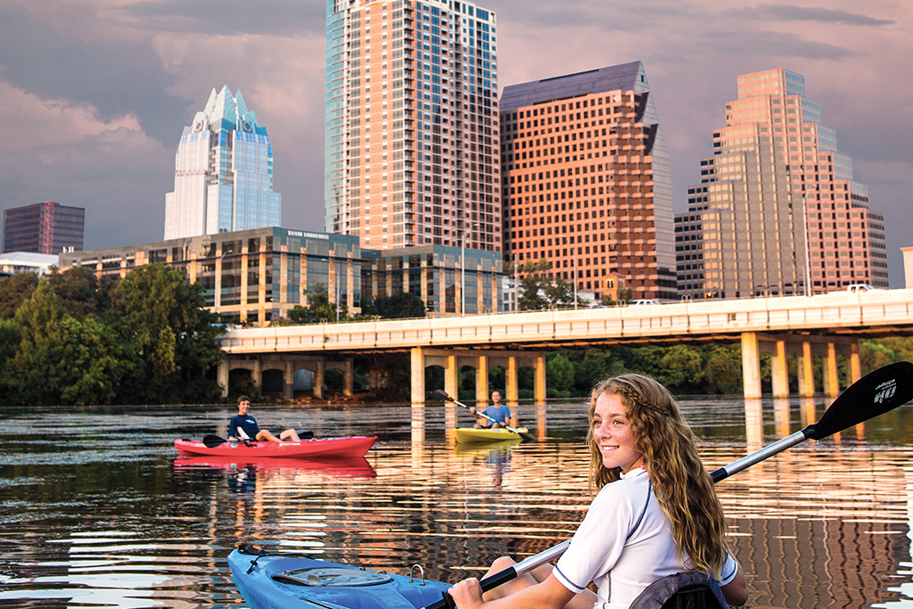
Limestone and Revolution
Austin’s urban geography is shaped by the way the Colorado River makes its smooth, curving path through the limestone hills of our capital city, carving out stunning vistas that have been inhabited by humans since at least 9200 B.C. After the Texas Revolution, the spot was chosen as the fledgling republic’s new capital because the land north of the Colorado River was so perfectly suited for human settlement.
Pollution and Power
By the middle of the 20th century, however, urban expansion had transformed the banks of the Colorado into an unruly, polluted mess, and the demands of urban life turned city leaders’ minds towards improving the river. In the 1960s, a dam was constructed to create Town Lake, which served a double purpose as a reservoir and a cooling pool for a power generation facility.
Saving the Lake
In the 1970s, further improvements created the renamed Lady Bird Lake, a long and narrow body of water ringed by parks and paths that stretches past the southern edge of downtown Austin. Today, Lady Bird Lake is a center of recreation, popular with boaters, paddleboarders, bikers, and swimmers who bathe in nearby Barton Springs, which feeds into the lake.
Follow this map to the great Texas rivers or jump into one of these lakes.

Chili is basically the state dish of Texas. Its popularity began in San Antonio during 19th-century wartime.
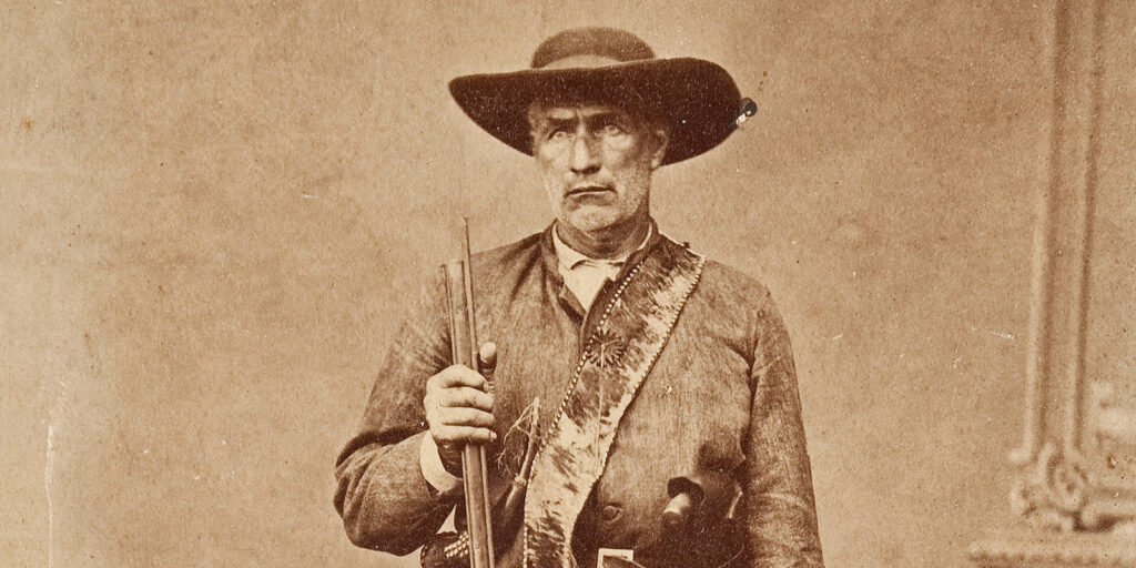
Mythic Heroes of the Texas Frontier
These are the heroes of Texas’ best stories — true or not true.
The True Story of the Wildcatters Who Transformed Texas
It took guts to drill for oil in the early days, but striking black gold was worth risking everything.
9 Infamous, Spooky Texas Legends
Plus, four stops for a haunted road trip through the Lone Star State.
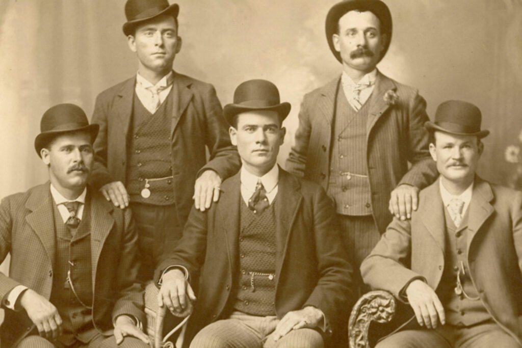
The Most Notorious Texas Outlaws
Texas lore is filled with outlaws and bandits who capitalized on the lawless frontier to lead lives of crime and villainy. But who are the most notorious outlaws in Texas history? Here are our picks.

A Newcomer’s Texas Slang Dictionary
Can you say Bexar, Boerne, Bowie, and Buda?